
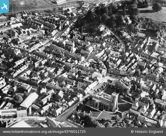
EPW011725 ENGLAND (1924). The town centre, Yeovil, 1924. This image has been produced from a copy-negative.
© Copyright OpenStreetMap contributors and licensed by the OpenStreetMap Foundation. 2026. Cartography is licensed as CC BY-SA.
Nearby Images (18)
EPW011725

EAW051929

EAW051183

EAW051187

EPW024027

EPW024008

EAW051185

EPW024009

EAW051186

EPW024010

EPW048466

EPW024007

EAW051188

EPW024015

EAW051930

EPW048462

EPW011726

EAW051189

Details
| Title | [EPW011725] The town centre, Yeovil, 1924. This image has been produced from a copy-negative. |
| Reference | EPW011725 |
| Date | 8-September-1924 |
| Link | |
| Place name | YEOVIL |
| Parish | YEOVIL |
| District | |
| Country | ENGLAND |
| Easting / Northing | 355745, 115961 |
| Longitude / Latitude | -2.6299485883937, 50.940842312786 |
| National Grid Reference | ST557160 |
Pins

Class31 |
Sunday 1st of February 2015 05:22:28 PM |
