
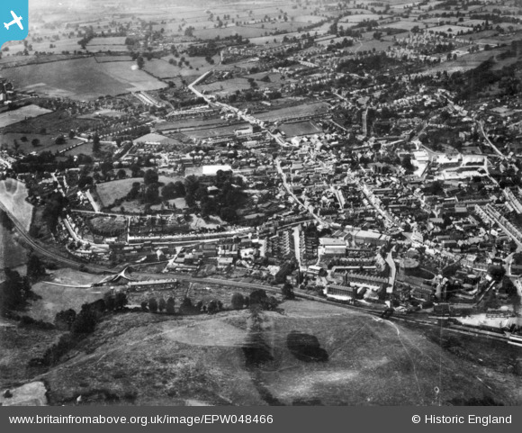
EPW048466 ENGLAND (1935). The town, Yeovil, 1935. This image has been produced from a copy-negative.
© Copyright OpenStreetMap contributors and licensed by the OpenStreetMap Foundation. 2026. Cartography is licensed as CC BY-SA.
Nearby Images (12)
EPW048466

EAW051186

EPW011725

EPW024010

EAW051183

EAW051929

EAW051187

EPW024015

EAW051930

EPW011726

EPW024007

EPW048462

Details
| Title | [EPW048466] The town, Yeovil, 1935. This image has been produced from a copy-negative. |
| Reference | EPW048466 |
| Date | July-1935 |
| Link | |
| Place name | YEOVIL |
| Parish | YEOVIL |
| District | |
| Country | ENGLAND |
| Easting / Northing | 355752, 115783 |
| Longitude / Latitude | -2.6298273267537, 50.939242127276 |
| National Grid Reference | ST558158 |


