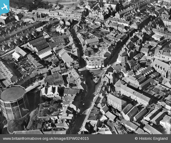
EPW024015 ENGLAND (1928). Middle Street and environs, Yeovil, 1928
© Copyright OpenStreetMap contributors and licensed by the OpenStreetMap Foundation. 2026. Cartography is licensed as CC BY-SA.
Nearby Images (13)
EPW024015

EPW011726

EPW024007

EAW051186

EAW051187

EPW011725

EAW051929

EAW051189

EPW011729

EPW048466

EAW051185

EPW024027

EAW051188

Details
| Title | [EPW024015] Middle Street and environs, Yeovil, 1928 |
| Reference | EPW024015 |
| Date | September-1928 |
| Link | |
| Place name | YEOVIL |
| Parish | YEOVIL |
| District | |
| Country | ENGLAND |
| Easting / Northing | 355944, 115910 |
| Longitude / Latitude | -2.6271099315214, 50.94039892292 |
| National Grid Reference | ST559159 |
Pins

JMW |
Thursday 23rd of March 2017 09:59:23 AM | |

Alan McFaden |
Sunday 13th of April 2014 10:04:43 AM | |

Class31 |
Thursday 7th of November 2013 08:50:08 PM | |
|
Class31 |
Thursday 7th of November 2013 08:45:46 PM | |
|
Class31 |
Saturday 29th of September 2012 08:58:18 PM | |
|
Class31 |
Saturday 29th of September 2012 08:56:43 PM | |
|
Class31 |
Saturday 29th of September 2012 08:56:11 PM | |
|
Class31 |
Saturday 29th of September 2012 08:55:34 PM |