
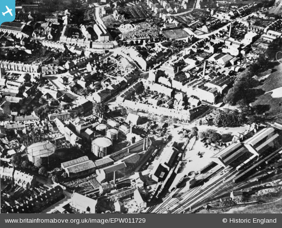
EPW011729 ENGLAND (1924). Station Road and environs, Yeovil, 1924. This image has been produced from a copy-negative.
© Copyright OpenStreetMap contributors and licensed by the OpenStreetMap Foundation. 2026. Cartography is licensed as CC BY-SA.
Nearby Images (5)
EPW011729

EPW011726

EPW024015

EPW024007

EAW051189

Details
| Title | [EPW011729] Station Road and environs, Yeovil, 1924. This image has been produced from a copy-negative. |
| Reference | EPW011729 |
| Date | 8-September-1924 |
| Link | |
| Place name | YEOVIL |
| Parish | YEOVIL |
| District | |
| Country | ENGLAND |
| Easting / Northing | 356153, 115972 |
| Longitude / Latitude | -2.6241425997099, 50.940972414891 |
| National Grid Reference | ST562160 |
