
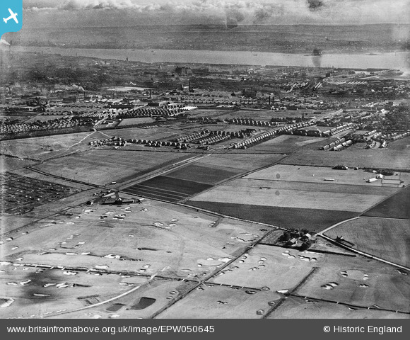
EPW050645 ENGLAND (1936). Bootle Golf Course, housing development around Kirkstone Road South and Church Road and environs, Litherland, from the north-east, 1936
© Hawlfraint cyfranwyr OpenStreetMap a thrwyddedwyd gan yr OpenStreetMap Foundation. 2026. Trwyddedir y gartograffeg fel CC BY-SA.
Delweddau cyfagos (9)
EPW050645

EPW050665

EAW050725
, Litherland, from the north-east, 1953")
EPW050646

EPW050650

EAW050724
, Litherland, from the north-east, 1953")
EPW050647

EPW050648

EAW050723

Manylion
| Pennawd | [EPW050645] Bootle Golf Course, housing development around Kirkstone Road South and Church Road and environs, Litherland, from the north-east, 1936 |
| Cyfeirnod | EPW050645 |
| Dyddiad | June-1936 |
| Dolen | |
| Enw lle | LITHERLAND |
| Plwyf | |
| Ardal | |
| Gwlad | ENGLAND |
| Dwyreiniad / Gogleddiad | 334956, 398495 |
| Hydred / Lledred | -2.9801969026161, 53.478903222684 |
| Cyfeirnod Grid Cenedlaethol | SJ350985 |
Pinnau

Ange |
Saturday 26th of November 2022 07:52:40 PM | |
|
Lancashire Lass |
Wednesday 3rd of August 2022 02:34:40 PM | |
|
Alan Cooper |
Tuesday 29th of December 2020 04:35:46 PM | |
|
Alan Cooper |
Tuesday 29th of December 2020 04:34:28 PM | |
|
Alan Cooper |
Tuesday 29th of December 2020 04:31:25 PM | |
|
Lancashire Lass |
Tuesday 30th of August 2016 08:46:30 PM | |
|
Lancashire Lass |
Tuesday 30th of August 2016 08:45:27 PM | |
|
Lancashire Lass |
Tuesday 30th of August 2016 08:40:40 PM | |
|
Lancashire Lass |
Tuesday 30th of August 2016 08:38:21 PM | |
|
Lancashire Lass |
Tuesday 30th of August 2016 08:36:40 PM | |
|
Lancashire Lass |
Tuesday 30th of August 2016 08:35:44 PM |