
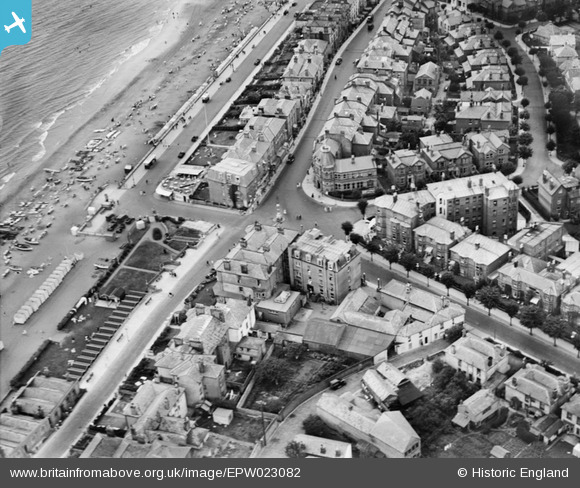
EPW023082 ENGLAND (1928). The junction of Victoria Road, High Street and Avenue Slipway, Sandown, 1928
© Hawlfraint cyfranwyr OpenStreetMap a thrwyddedwyd gan yr OpenStreetMap Foundation. 2026. Trwyddedir y gartograffeg fel CC BY-SA.
Delweddau cyfagos (6)
EPW023082

EAW038581

EPW043025

EAW022218

EPW043026

EPW016862

Manylion
| Pennawd | [EPW023082] The junction of Victoria Road, High Street and Avenue Slipway, Sandown, 1928 |
| Cyfeirnod | EPW023082 |
| Dyddiad | August-1928 |
| Dolen | |
| Enw lle | SANDOWN |
| Plwyf | SANDOWN |
| Ardal | |
| Gwlad | ENGLAND |
| Dwyreiniad / Gogleddiad | 460175, 84410 |
| Hydred / Lledred | -1.1486323787913, 50.655675018544 |
| Cyfeirnod Grid Cenedlaethol | SZ602844 |

