
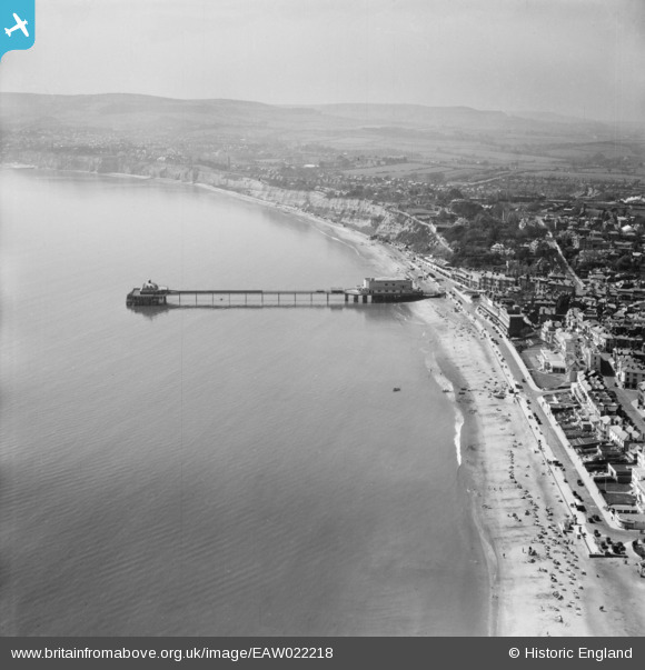
EAW022218 ENGLAND (1949). Sandown Pier, the Esplanade and the surrounding coastline, Sandown, from the north-east, 1949
© Hawlfraint cyfranwyr OpenStreetMap a thrwyddedwyd gan yr OpenStreetMap Foundation. 2026. Trwyddedir y gartograffeg fel CC BY-SA.
Delweddau cyfagos (6)
EAW022218

EAW038581

EPW043025

EPW023082

EPW023081

EPW039670

Manylion
| Pennawd | [EAW022218] Sandown Pier, the Esplanade and the surrounding coastline, Sandown, from the north-east, 1949 |
| Cyfeirnod | EAW022218 |
| Dyddiad | 17-April-1949 |
| Dolen | |
| Enw lle | SANDOWN |
| Plwyf | SANDOWN |
| Ardal | |
| Gwlad | ENGLAND |
| Dwyreiniad / Gogleddiad | 460148, 84204 |
| Hydred / Lledred | -1.149047808698, 50.653825287994 |
| Cyfeirnod Grid Cenedlaethol | SZ601842 |
Pinnau
Byddwch y cyntaf i ychwanegu sylw at y ddelwedd hon!