
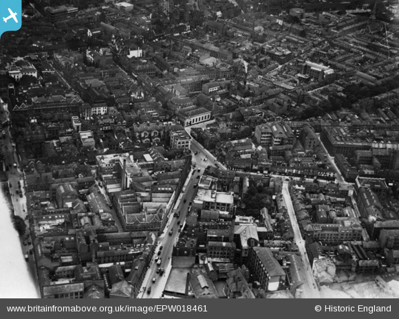
EPW018461 ENGLAND (1927). Welford Place and Newarke Street, Leicester, 1927. This image has been produced from a print.
© Hawlfraint cyfranwyr OpenStreetMap a thrwyddedwyd gan yr OpenStreetMap Foundation. 2026. Trwyddedir y gartograffeg fel CC BY-SA.
Delweddau cyfagos (20)
EPW018461

EPW020816

EPW018415

EPW020825

EAW024241

EPW020818

EPW020815

EAW051830

EPW020817

EPW020822

EPW020819

EPW020814

EAW051828

EPW020826

EPW020824

EPW055010

EPW047868

EPW018421

EPW008477

EPW047642

Manylion
| Pennawd | [EPW018461] Welford Place and Newarke Street, Leicester, 1927. This image has been produced from a print. |
| Cyfeirnod | EPW018461 |
| Dyddiad | June-1927 |
| Dolen | |
| Enw lle | LEICESTER |
| Plwyf | |
| Ardal | |
| Gwlad | ENGLAND |
| Dwyreiniad / Gogleddiad | 458761, 304145 |
| Hydred / Lledred | -1.1316937359895, 52.631522516509 |
| Cyfeirnod Grid Cenedlaethol | SK588041 |
