
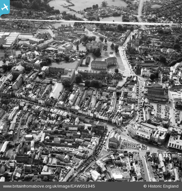
EAW051945 ENGLAND (1953). The town centre, Taunton, 1953. This image was marked by Aerofilms Ltd for photo editing.
© Copyright OpenStreetMap contributors and licensed by the OpenStreetMap Foundation. 2026. Cartography is licensed as CC BY-SA.
Nearby Images (40)
EAW051945

EAW051946

EAW049104

EAW051947

EAW005138

EPW027892

EPW041182

EAW005344

EAW005346

EAW051943

EAW005345

EAW005139

EPW013545

EPW013541

EAW005347

EAW015039

EAW049103

EAW015036

EAW015038

EPW027886

EPW041181

EPW027899

EAW005140

EAW005137

EAW051942

EPW041184

EPW027893

EAW051941

EPW027891

EPW041094

EAW005342

EPW041183

EAW015037

EAW005136

EAW005135

EPW041093

EAW005340

EAW051944

EAW005141

EPW027885

Details
| Title | [EAW051945] The town centre, Taunton, 1953. This image was marked by Aerofilms Ltd for photo editing. |
| Reference | EAW051945 |
| Date | 30-August-1953 |
| Link | |
| Place name | TAUNTON |
| Parish | |
| District | |
| Country | ENGLAND |
| Easting / Northing | 322596, 124379 |
| Longitude / Latitude | -3.1035279868836, 51.013035976066 |
| National Grid Reference | ST226244 |
Pins

redmist |
Monday 18th of December 2023 08:20:54 PM | |
|
redmist |
Monday 18th of December 2023 08:16:23 PM | |
|
redmist |
Monday 18th of December 2023 08:14:16 PM | |
|
redmist |
Monday 18th of December 2023 08:12:46 PM |