
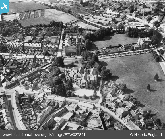
EPW027891 ENGLAND (1929). Shire Hall, Taunton, 1929. This image has been produced from a copy-negative.
© Copyright OpenStreetMap contributors and licensed by the OpenStreetMap Foundation. 2026. Cartography is licensed as CC BY-SA.
Nearby Images (19)
EPW027891

EAW005140

EAW005136

EAW015039

EAW051942

EAW005135

EAW005139

EAW005137

EAW015038

EAW005345

EAW015037

EAW005344

EAW005138

EAW005141

EAW049104

EAW051946

EAW049103

EAW051945

EPW041182

Details
| Title | [EPW027891] Shire Hall, Taunton, 1929. This image has been produced from a copy-negative. |
| Reference | EPW027891 |
| Date | 28-June-1929 |
| Link | |
| Place name | TAUNTON |
| Parish | |
| District | |
| Country | ENGLAND |
| Easting / Northing | 322367, 124344 |
| Longitude / Latitude | -3.1067846356908, 51.012690395595 |
| National Grid Reference | ST224243 |
Pins
Be the first to add a comment to this image!