
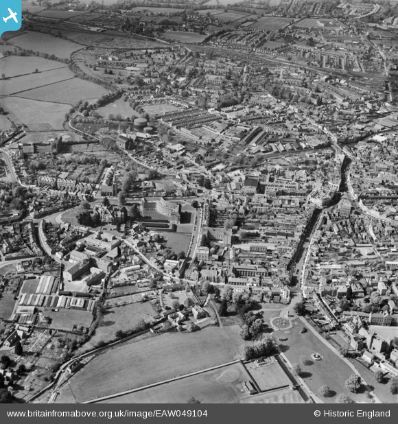
EAW049104 ENGLAND (1953). The town centre, Taunton, 1953
© Copyright OpenStreetMap contributors and licensed by the OpenStreetMap Foundation. 2026. Cartography is licensed as CC BY-SA.
Nearby Images (37)
EAW049104

EAW051946

EAW005344

EAW005139

EAW005138

EAW015039

EPW041182

EAW005345

EAW051945

EAW049103

EAW051942

EAW015037

EAW005140

EAW005136

EPW027891

EAW015038

EAW005137

EAW005135

EAW051947

EAW051943

EAW005346

EAW005141

EAW005340

EAW051948

EAW005342

EPW027886

EPW013541

EPW041184

EPW013545

EPW027892

EAW005337

EPW041183

EPW041094

EAW005347

EAW005341

EAW005339

EPW041093

Details
| Title | [EAW049104] The town centre, Taunton, 1953 |
| Reference | EAW049104 |
| Date | 6-May-1953 |
| Link | |
| Place name | TAUNTON |
| Parish | |
| District | |
| Country | ENGLAND |
| Easting / Northing | 322494, 124416 |
| Longitude / Latitude | -3.1049897911524, 51.01335492357 |
| National Grid Reference | ST225244 |
Pins

redmist |
Sunday 17th of December 2023 04:20:05 PM | |
|
redmist |
Sunday 17th of December 2023 04:17:50 PM | |
|
Newbie20 |
Thursday 25th of February 2021 07:22:42 AM | |
|
Newbie20 |
Thursday 25th of February 2021 07:06:57 AM | |
|
Somerset Chick |
Saturday 18th of March 2017 11:25:51 PM | |
|
Somerset Chick |
Saturday 18th of March 2017 11:24:48 PM |