
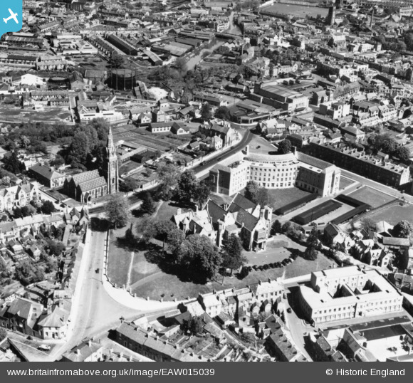
EAW015039 ENGLAND (1948). Shire Hall and County Hall, Taunton, 1948. This image has been produced from a print.
© Copyright OpenStreetMap contributors and licensed by the OpenStreetMap Foundation. 2026. Cartography is licensed as CC BY-SA.
Nearby Images (22)
EAW015039

EAW005139

EAW051942

EAW005140

EAW005344

EPW027891

EAW005136

EAW005345

EAW015037

EAW005138

EAW015038

EAW005135

EAW005137

EAW049104

EAW005141

EAW051946

EAW049103

EAW051945

EPW041182

EPW013545

EAW005342

EPW041183

Details
| Title | [EAW015039] Shire Hall and County Hall, Taunton, 1948. This image has been produced from a print. |
| Reference | EAW015039 |
| Date | 27-April-1948 |
| Link | |
| Place name | TAUNTON |
| Parish | |
| District | |
| Country | ENGLAND |
| Easting / Northing | 322408, 124367 |
| Longitude / Latitude | -3.1062051511092, 51.01290273644 |
| National Grid Reference | ST224244 |
Pins

Somerset Chick |
Saturday 18th of March 2017 11:50:16 PM | |
|
Somerset Chick |
Saturday 18th of March 2017 11:49:22 PM |