
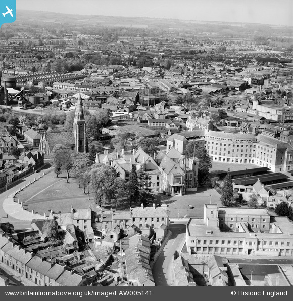
EAW005141 ENGLAND (1947). St John's Church, the Shire Hall and County Hall, Taunton, from the south, 1947
© Copyright OpenStreetMap contributors and licensed by the OpenStreetMap Foundation. 2026. Cartography is licensed as CC BY-SA.
Nearby Images (17)
EAW005141

EAW005137

EAW005135

EAW015038

EAW005140

EPW027891

EAW005345

EAW005139

EAW005136

EAW005138

EAW015039

EAW005344

EAW051942

EAW015037

EAW049104

EAW051946

EAW051945

Details
| Title | [EAW005141] St John's Church, the Shire Hall and County Hall, Taunton, from the south, 1947 |
| Reference | EAW005141 |
| Date | 7-September-1947 |
| Link | |
| Place name | TAUNTON |
| Parish | |
| District | |
| Country | ENGLAND |
| Easting / Northing | 322373, 124224 |
| Longitude / Latitude | -3.1066734303817, 51.01161221626 |
| National Grid Reference | ST224242 |
Pins
Be the first to add a comment to this image!