
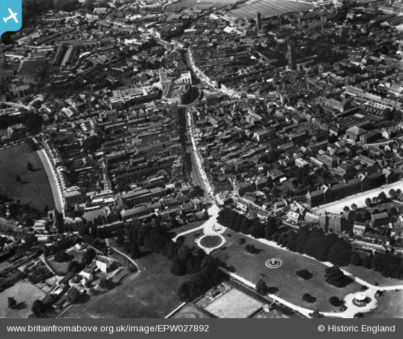
EPW027892 ENGLAND (1929). The town centre, Taunton, 1929. This image has been produced from a print.
© Copyright OpenStreetMap contributors and licensed by the OpenStreetMap Foundation. 2026. Cartography is licensed as CC BY-SA.
Nearby Images (20)
EPW027892

EAW015036

EPW013545

EAW051945

EAW051941

EAW051947

EAW005346

EAW051946

EAW005347

EAW051943

EPW013541

EPW027893

EPW041181

EPW027899

EAW005138

EPW027898

EAW049104

EPW041180

EPW041182

EAW049103

Details
| Title | [EPW027892] The town centre, Taunton, 1929. This image has been produced from a print. |
| Reference | EPW027892 |
| Date | 28-June-1929 |
| Link | |
| Place name | TAUNTON |
| Parish | |
| District | |
| Country | ENGLAND |
| Easting / Northing | 322713, 124307 |
| Longitude / Latitude | -3.101844937119, 51.012404320917 |
| National Grid Reference | ST227243 |
Pins

Somerset Chick |
Thursday 15th of September 2016 04:59:42 PM | |
|
Somerset Chick |
Thursday 15th of September 2016 04:59:03 PM | |
|
Somerset Chick |
Thursday 15th of September 2016 04:58:13 PM | |
|
gBr |
Friday 22nd of January 2016 09:11:53 PM |