
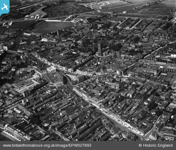
EPW027893 ENGLAND (1929). The town centre, Taunton, 1929. This image has been produced from a print.
© Copyright OpenStreetMap contributors and licensed by the OpenStreetMap Foundation. 2026. Cartography is licensed as CC BY-SA.
Nearby Images (29)
EPW027893

EPW027899

EPW041181

EAW005347

EPW013541

EAW051941

EPW027885

EAW005346

EAW051944

EAW051943

EAW051947

EAW005343

EPW027886

EPW041093

EPW013539

EPW041184

EPW041094

EPW041183

EAW015036

EAW005339

EAW005342

EPW027892

EAW005341

EAW005337

EAW051945

EAW005340

EPW041182

EAW051946

EAW005338

Details
| Title | [EPW027893] The town centre, Taunton, 1929. This image has been produced from a print. |
| Reference | EPW027893 |
| Date | 28-June-1929 |
| Link | |
| Place name | TAUNTON |
| Parish | |
| District | |
| Country | ENGLAND |
| Easting / Northing | 322779, 124512 |
| Longitude / Latitude | -3.1009478396585, 51.014256465753 |
| National Grid Reference | ST228245 |
Pins

gBr |
Thursday 21st of January 2016 10:40:05 PM | |

Maurice |
Sunday 2nd of November 2014 07:04:04 AM | |
|
Taunton_Lad |
Sunday 2nd of November 2014 02:48:00 AM |