
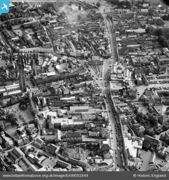
EAW051944 ENGLAND (1953). The town centre, Taunton, 1953
© Copyright OpenStreetMap contributors and licensed by the OpenStreetMap Foundation. 2026. Cartography is licensed as CC BY-SA.
Nearby Images (29)
EAW051944

EPW027885

EPW027899

EPW041181

EPW027893

EAW005347

EPW041093

EPW013541

EPW027886

EPW041094

EPW041184

EAW005343

EAW051943

EPW041183

EAW005346

EAW005339

EAW051947

EAW005342

EPW013539

EAW051941

EAW005341

EAW005337

EAW005340

EAW005338

EPW013543

EPW027895

EPW041182

EAW051945

EAW051946

Details
| Title | [EAW051944] The town centre, Taunton, 1953 |
| Reference | EAW051944 |
| Date | 30-August-1953 |
| Link | |
| Place name | TAUNTON |
| Parish | |
| District | |
| Country | ENGLAND |
| Easting / Northing | 322760, 124591 |
| Longitude / Latitude | -3.1012354969123, 51.01496424918 |
| National Grid Reference | ST228246 |
Pins

redmist |
Monday 18th of December 2023 08:11:07 PM | |
|
redmist |
Monday 18th of December 2023 08:06:36 PM | |
|
Nigel |
Sunday 6th of June 2021 02:33:36 PM | |
|
finney |
Thursday 8th of April 2021 02:50:23 PM | |
|
Somerset Chick |
Sunday 19th of March 2017 12:02:30 AM |