
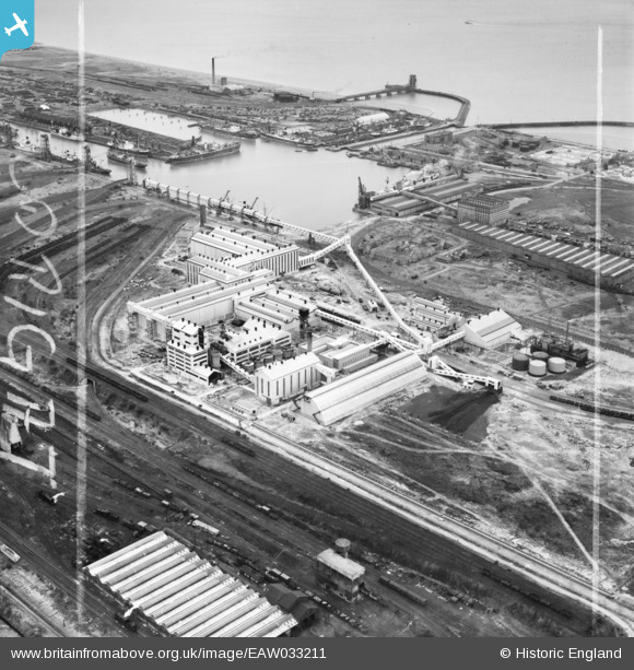
EAW033211 ENGLAND (1950). The Fisons Ltd Chemical Works and Immingham Dock, Immingham, 1950. This image was marked by Aerofilms Ltd for photo editing.
© Copyright OpenStreetMap contributors and licensed by the OpenStreetMap Foundation. 2026. Cartography is licensed as CC BY-SA.
Nearby Images (20)
EAW033211

EAW033209

EAW033215

EAW033210

EAW033218

EAW033212

EAW033216

EAW029100

EAW029097

EAW033219

EAW029099

EAW029102

EAW029093

EAW033217

EAW029094

EAW033214

EAW033208

EAW033205

EAW029096

EAW033213

Details
| Title | [EAW033211] The Fisons Ltd Chemical Works and Immingham Dock, Immingham, 1950. This image was marked by Aerofilms Ltd for photo editing. |
| Reference | EAW033211 |
| Date | 6-October-1950 |
| Link | |
| Place name | IMMINGHAM |
| Parish | IMMINGHAM |
| District | |
| Country | ENGLAND |
| Easting / Northing | 519826, 415523 |
| Longitude / Latitude | -0.18807457230765, 53.622279085786 |
| National Grid Reference | TA198155 |
Pins

John Wass |
Friday 11th of July 2014 08:20:42 PM |