
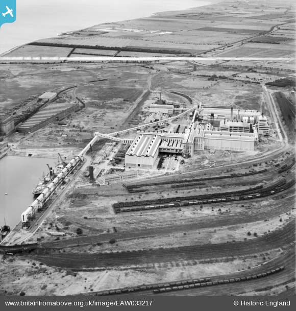
EAW033217 ENGLAND (1950). The Fisons Ltd Chemical Works, Immingham, 1950. This image was marked by Aerofilms Ltd for photo editing.
© Copyright OpenStreetMap contributors and licensed by the OpenStreetMap Foundation. 2026. Cartography is licensed as CC BY-SA.
Nearby Images (18)
EAW033217

EAW033208

EAW033219

EAW029094

EAW033205

EAW029096

EAW033214

EAW033213

EAW033207

EAW033206

EAW033218

EAW033210

EAW033212

EAW029093

EAW033209

EAW033211

EAW033215

EAW029101

Details
| Title | [EAW033217] The Fisons Ltd Chemical Works, Immingham, 1950. This image was marked by Aerofilms Ltd for photo editing. |
| Reference | EAW033217 |
| Date | 6-October-1950 |
| Link | |
| Place name | IMMINGHAM |
| Parish | IMMINGHAM |
| District | |
| Country | ENGLAND |
| Easting / Northing | 519700, 415673 |
| Longitude / Latitude | -0.18992113048473, 53.623655622664 |
| National Grid Reference | TA197157 |
Pins

redmist |
Saturday 23rd of February 2019 10:22:54 PM |