
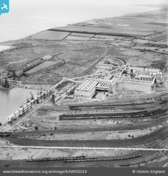
EAW033219 ENGLAND (1950). The Fisons Ltd Chemical Works, Immingham, 1950. This image was marked by Aerofilms Ltd for photo editing.
© Copyright OpenStreetMap contributors and licensed by the OpenStreetMap Foundation. 2026. Cartography is licensed as CC BY-SA.
Nearby Images (18)
EAW033219

EAW033217

EAW033214

EAW033208

EAW033205

EAW029094

EAW029096

EAW033213

EAW033218

EAW033207

EAW033206

EAW033212

EAW033210

EAW033209

EAW033211

EAW029093

EAW033215

EAW029101

Details
| Title | [EAW033219] The Fisons Ltd Chemical Works, Immingham, 1950. This image was marked by Aerofilms Ltd for photo editing. |
| Reference | EAW033219 |
| Date | 6-October-1950 |
| Link | |
| Place name | IMMINGHAM |
| Parish | IMMINGHAM |
| District | |
| Country | ENGLAND |
| Easting / Northing | 519737, 415676 |
| Longitude / Latitude | -0.18936077712814, 53.623674117081 |
| National Grid Reference | TA197157 |
