
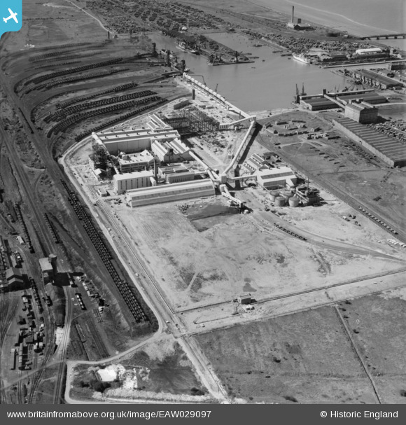
EAW029097 ENGLAND (1950). Immingham Dock, Immingham, 1950
© Copyright OpenStreetMap contributors and licensed by the OpenStreetMap Foundation. 2026. Cartography is licensed as CC BY-SA.
Nearby Images (11)
EAW029097

EAW029100

EAW033215

EAW033216

EAW029099

EAW033211

EAW033209

EAW033210

EAW033212

EAW033218

EAW029102

Details
| Title | [EAW029097] Immingham Dock, Immingham, 1950 |
| Reference | EAW029097 |
| Date | 4-May-1950 |
| Link | |
| Place name | IMMINGHAM |
| Parish | IMMINGHAM |
| District | |
| Country | ENGLAND |
| Easting / Northing | 519919, 415409 |
| Longitude / Latitude | -0.18671297902635, 53.621233531235 |
| National Grid Reference | TA199154 |
Pins
Be the first to add a comment to this image!