
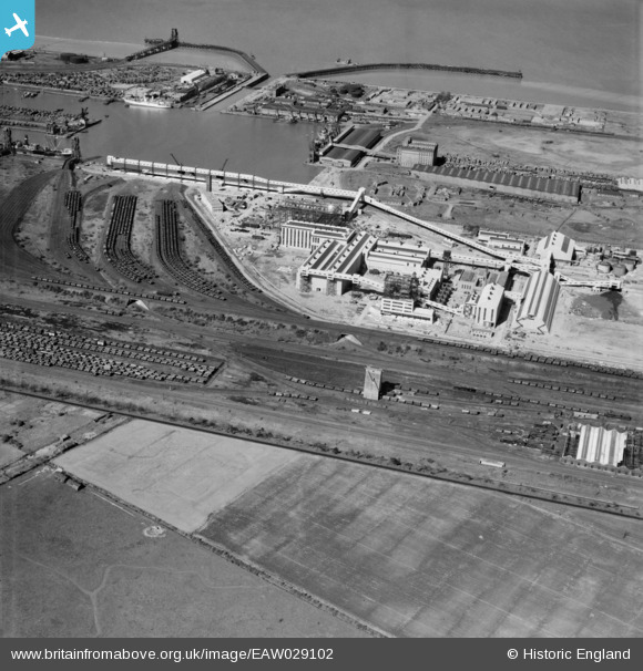
EAW029102 ENGLAND (1950). Immingham Dock, Immingham, 1950
© Copyright OpenStreetMap contributors and licensed by the OpenStreetMap Foundation. 2026. Cartography is licensed as CC BY-SA.
Nearby Images (12)
EAW029102

EAW033216

EAW029093

EAW033210

EAW033218

EAW033211

EAW033209

EAW033215

EAW029097

EAW029100

EAW029094

EAW033212

Details
| Title | [EAW029102] Immingham Dock, Immingham, 1950 |
| Reference | EAW029102 |
| Date | 4-May-1950 |
| Link | |
| Place name | IMMINGHAM |
| Parish | IMMINGHAM |
| District | |
| Country | ENGLAND |
| Easting / Northing | 519687, 415409 |
| Longitude / Latitude | -0.19021910958064, 53.621286610127 |
| National Grid Reference | TA197154 |
Pins

redmist |
Saturday 23rd of February 2019 11:04:41 PM | |
|
redmist |
Saturday 23rd of February 2019 11:03:34 PM | |

Sparky |
Sunday 22nd of October 2017 11:26:06 PM | |
|
Sparky |
Sunday 22nd of October 2017 11:25:34 PM | |
|
John Wass |
Saturday 12th of July 2014 11:03:56 AM | |
|
John Wass |
Friday 11th of July 2014 07:59:50 PM | |
|
John Wass |
Friday 11th of July 2014 07:59:47 PM | |
|
Pete65 |
Monday 17th of February 2014 02:14:29 PM |