
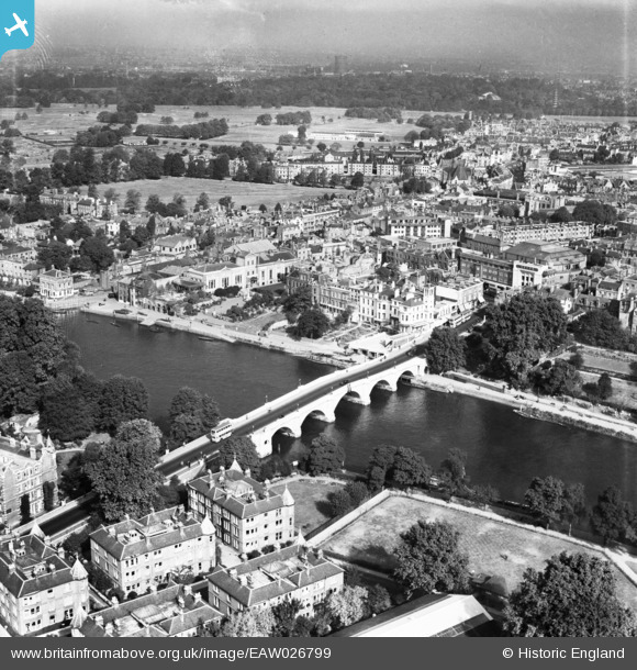
EAW026799 ENGLAND (1949). Richmond Bridge, Richmond, from the south, 1949
© Copyright OpenStreetMap contributors and licensed by the OpenStreetMap Foundation. 2026. Cartography is licensed as CC BY-SA.
Nearby Images (22)
EAW026799

EPW022844

EPW022837

EPW022838

EPW044552

EPW001695

EPW001693

EAW008242

EAW042759

EAW042757

EAW042758

EPW001694

EAW026798

EPW056173

EPW008871

EPW001696

EAW036494

EAW036500

EAW036497

EAW036493

EAW036495

EAW015165

Details
| Title | [EAW026799] Richmond Bridge, Richmond, from the south, 1949 |
| Reference | EAW026799 |
| Date | 3-October-1949 |
| Link | |
| Place name | RICHMOND |
| Parish | |
| District | |
| Country | ENGLAND |
| Easting / Northing | 517703, 174462 |
| Longitude / Latitude | -0.30570114065189, 51.456396607246 |
| National Grid Reference | TQ177745 |
Pins

Brian Davies |
Sunday 15th of April 2018 11:02:20 PM | |
|
Brian Davies |
Sunday 15th of April 2018 11:01:39 PM | |
|
MB |
Tuesday 4th of March 2014 06:52:12 PM | |
|
MB |
Tuesday 4th of March 2014 06:50:55 PM | |
|
MB |
Tuesday 4th of March 2014 06:50:28 PM | |
|
MB |
Tuesday 4th of March 2014 06:49:19 PM | |
|
MB |
Tuesday 4th of March 2014 06:48:53 PM | |
|
MB |
Tuesday 4th of March 2014 06:48:14 PM | |
|
MB |
Tuesday 4th of March 2014 06:47:25 PM | |
|
MB |
Tuesday 4th of March 2014 06:46:47 PM |