
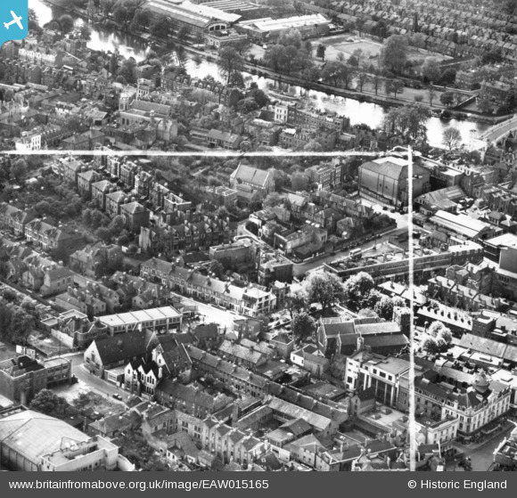
EAW015165 ENGLAND (1948). St Mary Magdelene's Church, Halford Road and environs, Richmond, 1948. This image has been produced from a print marked by Aerofilms Ltd for photo editing.
© Copyright OpenStreetMap contributors and licensed by the OpenStreetMap Foundation. 2026. Cartography is licensed as CC BY-SA.
Nearby Images (14)
EAW015165

EAW015163

EAW015162

EAW015164

EPW008871

EPW022842

EAW042758

EPW056173

EPW056167

EAW042759

EAW008242

EPW022837

EPW022844

EAW026799

Details
| Title | [EAW015165] St Mary Magdelene's Church, Halford Road and environs, Richmond, 1948. This image has been produced from a print marked by Aerofilms Ltd for photo editing. |
| Reference | EAW015165 |
| Date | 5-May-1948 |
| Link | |
| Place name | RICHMOND |
| Parish | |
| District | |
| Country | ENGLAND |
| Easting / Northing | 517948, 174708 |
| Longitude / Latitude | -0.30209404189079, 51.458556805898 |
| National Grid Reference | TQ179747 |
Pins
Be the first to add a comment to this image!