
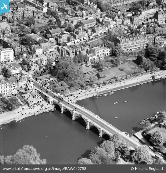
EAW042758 ENGLAND (1952). Richmond Bridge, Richmond, 1952. This image has been produced from a damaged negative.
© Copyright OpenStreetMap contributors and licensed by the OpenStreetMap Foundation. 2026. Cartography is licensed as CC BY-SA.
Nearby Images (27)
EAW042758

EAW042759

EPW008871

EPW056173

EAW008242

EPW022837

EPW022844

EPW022838

EAW026798

EPW044552

EAW026799

EAW042757

EPW001695

EPW001693

EAW015165

EPW022842

EAW015163

EAW015162

EPW031989

EPW031991

EPW001694

EPW031987

EPW031992

EPW036448

EPW031988

EPW031990

EPW036443

Details
| Title | [EAW042758] Richmond Bridge, Richmond, 1952. This image has been produced from a damaged negative. |
| Reference | EAW042758 |
| Date | 29-April-1952 |
| Link | |
| Place name | RICHMOND |
| Parish | |
| District | |
| Country | ENGLAND |
| Easting / Northing | 517813, 174547 |
| Longitude / Latitude | -0.30409014855508, 51.457137755112 |
| National Grid Reference | TQ178745 |
Pins
Be the first to add a comment to this image!