
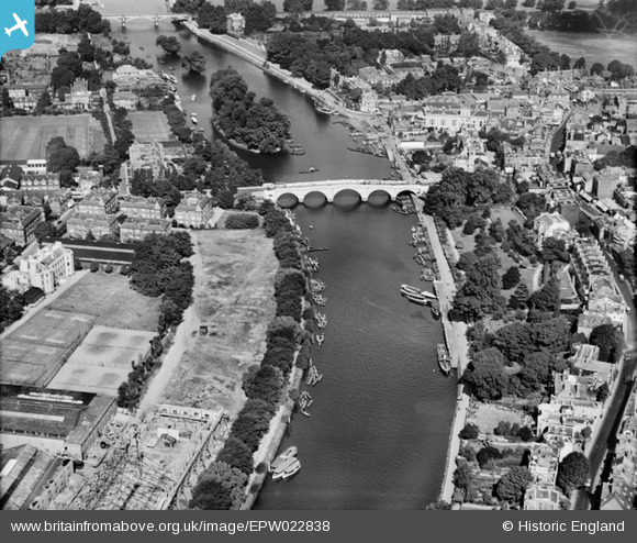
EPW022838 ENGLAND (1928). Richmond Bridge, Richmond, 1928
© Copyright OpenStreetMap contributors and licensed by the OpenStreetMap Foundation. 2026. Cartography is licensed as CC BY-SA.
Nearby Images (23)
EPW022838

EPW022844

EAW026799

EPW022837

EPW001693

EAW042757

EPW001695

EPW044552

EAW026798

EAW042759

EAW008242

EAW042758

EPW008871

EPW056173

EPW001694

EAW036494

EPW001696

EAW036493

EAW036500

EAW036497

EAW036495

EPW036445

EPW036448

Details
| Title | [EPW022838] Richmond Bridge, Richmond, 1928 |
| Reference | EPW022838 |
| Date | August-1928 |
| Link | |
| Place name | RICHMOND |
| Parish | |
| District | |
| Country | ENGLAND |
| Easting / Northing | 517746, 174443 |
| Longitude / Latitude | -0.30508878665014, 51.456216879464 |
| National Grid Reference | TQ177744 |
Pins

Alan McFaden |
Friday 29th of March 2013 10:27:26 AM |
