
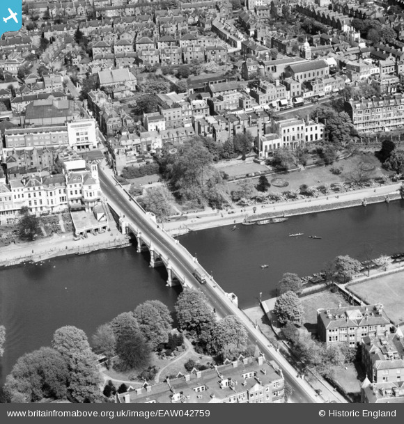
EAW042759 ENGLAND (1952). Richmond Bridge and the surrounding area, Richmond, 1952
© Copyright OpenStreetMap contributors and licensed by the OpenStreetMap Foundation. 2026. Cartography is licensed as CC BY-SA.
Nearby Images (27)
EAW042759

EAW042758

EPW008871

EAW008242

EPW022837

EPW022844

EPW056173

EPW022838

EPW044552

EAW026799

EAW026798

EAW042757

EPW001695

EPW001693

EAW015165

EPW001694

EPW031989

EPW031991

EPW031987

EPW031992

EAW015163

EPW031988

EAW015162

EPW031990

EPW036445

EPW036448

EPW036443

Details
| Title | [EAW042759] Richmond Bridge and the surrounding area, Richmond, 1952 |
| Reference | EAW042759 |
| Date | 29-April-1952 |
| Link | |
| Place name | RICHMOND |
| Parish | |
| District | |
| Country | ENGLAND |
| Easting / Northing | 517788, 174540 |
| Longitude / Latitude | -0.30445218422964, 51.45708003801 |
| National Grid Reference | TQ178745 |
Pins

richmondboy |
Thursday 5th of July 2018 11:27:13 AM |