
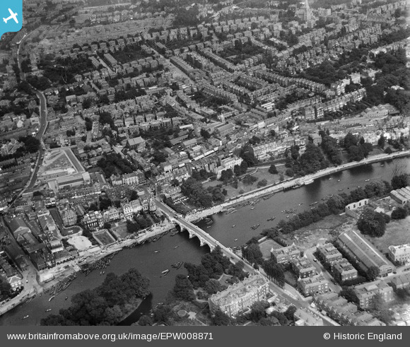
EPW008871 ENGLAND (1923). Richmond Bridge and the town centre, Richmond, 1923
© Copyright OpenStreetMap contributors and licensed by the OpenStreetMap Foundation. 2026. Cartography is licensed as CC BY-SA.
Nearby Images (24)
EPW008871

EAW042758

EAW042759

EAW026798

EPW056173

EAW008242

EPW022844

EAW042757

EPW022837

EPW022838

EAW026799

EPW044552

EAW015165

EPW001695

EPW001693

EAW015163

EAW015162

EPW036445

EPW036448

EAW026800

EPW036443

EPW031989

EPW031991

EPW036444

Details
| Title | [EPW008871] Richmond Bridge and the town centre, Richmond, 1923 |
| Reference | EPW008871 |
| Date | July-1923 |
| Link | |
| Place name | RICHMOND |
| Parish | |
| District | |
| Country | ENGLAND |
| Easting / Northing | 517848, 174536 |
| Longitude / Latitude | -0.30359022962047, 51.457031593704 |
| National Grid Reference | TQ178745 |
Pins
Be the first to add a comment to this image!