
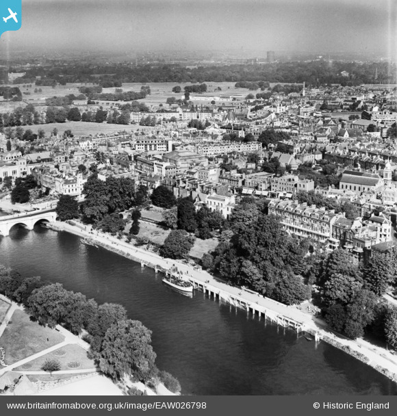
EAW026798 ENGLAND (1949). The town, Richmond, from the south, 1949
© Copyright OpenStreetMap contributors and licensed by the OpenStreetMap Foundation. 2026. Cartography is licensed as CC BY-SA.
Nearby Images (29)
EAW026798

EAW042757

EPW022838

EPW008871

EAW042758

EAW042759

EPW022844

EAW026799

EPW022837

EPW001693

EAW036494

EPW036445

EAW008242

EPW044552

EPW001695

EAW036493

EPW036448

EAW026800

EPW036449

EAW036495

EPW056173

EAW036500

EAW036497

EPW036443

EPW036450

EPW001696

EPW036444

EPW036447

EPW036446

Details
| Title | [EAW026798] The town, Richmond, from the south, 1949 |
| Reference | EAW026798 |
| Date | 3-October-1949 |
| Link | |
| Place name | RICHMOND |
| Parish | |
| District | |
| Country | ENGLAND |
| Easting / Northing | 517848, 174425 |
| Longitude / Latitude | -0.30362722392725, 51.456033855922 |
| National Grid Reference | TQ178744 |
Pins

Mart |
Thursday 23rd of May 2019 11:10:10 AM | |
|
Mart |
Thursday 23rd of May 2019 11:09:20 AM | |
|
MB |
Tuesday 4th of March 2014 06:57:08 PM | |
|
MB |
Tuesday 4th of March 2014 06:56:29 PM | |
|
MB |
Tuesday 4th of March 2014 06:55:59 PM | |
|
MB |
Tuesday 4th of March 2014 06:55:01 PM | |
|
MB |
Tuesday 4th of March 2014 06:54:23 PM | |
|
MB |
Tuesday 4th of March 2014 06:53:33 PM |