
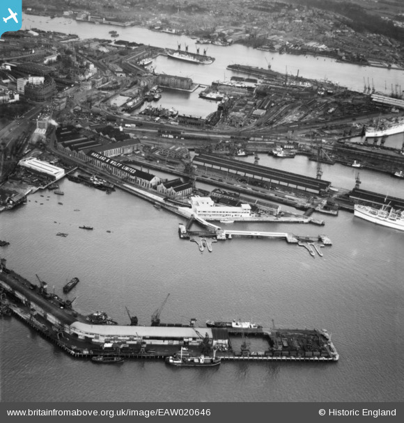
EAW020646 ENGLAND (1948). The British Overseas Airways Corporation (BOAC) Marine Airport and the surrounding docks, Southampton, 1948
© Copyright OpenStreetMap contributors and licensed by the OpenStreetMap Foundation. 2026. Cartography is licensed as CC BY-SA.
Nearby Images (36)
EAW020646
 Marine Airport and the surrounding docks, Southampton, 1948")
EAW189228

EAW008802

EAW020645
 Marine Airport and the surrounding docks, Southampton, 1948")
EAW020647
 Marine Airport and the surrounding docks, Southampton, 1948")
EAW001358

EPW020452

EAW008796

EPW037430

EPW020455

EPW032342

EAW001375

EAW001347

EPW041073

EAW008803

EAW001355

EAW008795

EAW015267

EAW008791

EAW008798

EAW008800

EAW033415

EAW008812

EAW001374
 in Ocean Dock, Southampton, 1946")
EPW020527

EAW008845

EAW008801

EPW009074

EAW001361

EPW020445

EAW015268

EAW001370
 in Ocean Dock, Southampton, 1946")
EPW041065

EAW001368
 in Ocean Dock, Southampton, 1946")
EAW046507

EAW046508

Details
| Title | [EAW020646] The British Overseas Airways Corporation (BOAC) Marine Airport and the surrounding docks, Southampton, 1948 |
| Reference | EAW020646 |
| Date | 8-December-1948 |
| Link | |
| Place name | SOUTHAMPTON |
| Parish | |
| District | |
| Country | ENGLAND |
| Easting / Northing | 442148, 110664 |
| Longitude / Latitude | -1.4006539662991, 50.893364780733 |
| National Grid Reference | SU421107 |


