
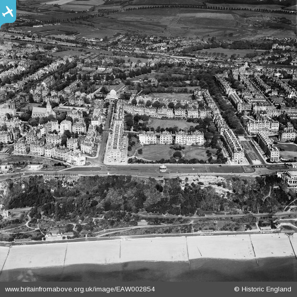
EAW002854 ENGLAND (1946). West Cliff, Clifton Gardens and the surrounding residential area, Folkestone, 1946
© Copyright OpenStreetMap contributors and licensed by the OpenStreetMap Foundation. 2026. Cartography is licensed as CC BY-SA.
Nearby Images (22)
EAW002854

EPW000364

EAW024830

EPW009201

EAW002855

EPW009197

EPW000588

EAW024828

EPW000592

EAW002375

EPW035414

EAW002370

EPW000366

EAW002374

EAW024829

EPW000082

EPW009199

EAW024827

EPW000583

EPW000085

EAW002867

EAW024833

Details
| Title | [EAW002854] West Cliff, Clifton Gardens and the surrounding residential area, Folkestone, 1946 |
| Reference | EAW002854 |
| Date | 1-October-1946 |
| Link | |
| Place name | FOLKESTONE |
| Parish | FOLKESTONE |
| District | |
| Country | ENGLAND |
| Easting / Northing | 622164, 135553 |
| Longitude / Latitude | 1.1719073804014, 51.075692078457 |
| National Grid Reference | TR222356 |
Pins

Matt Aldred edob.mattaldred.com |
Wednesday 9th of July 2025 12:49:31 PM | |
|
Matt Aldred edob.mattaldred.com |
Wednesday 9th of July 2025 12:48:47 PM | |

Sparky |
Saturday 16th of September 2017 12:21:18 PM | |
|
Sparky |
Saturday 16th of September 2017 12:20:11 PM | |
|
Sparky |
Saturday 16th of September 2017 12:17:07 PM | |
|
Sparky |
Saturday 16th of September 2017 12:15:55 PM | |
|
Sparky |
Saturday 16th of September 2017 12:15:07 PM |