
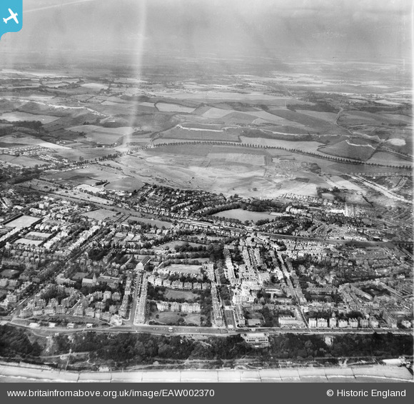
EAW002370 ENGLAND (1946). The area between Clifton Gardens and Radnor Park, Folkestone, from the south, 1946
© Copyright OpenStreetMap contributors and licensed by the OpenStreetMap Foundation. 2026. Cartography is licensed as CC BY-SA.
Nearby Images (14)
EAW002370

EPW000588

EAW002855

EPW000364

EAW002854

EPW009199

EAW024830

EPW009197

EAW002857

EAW002856

EPW000366

EAW002868

EAW024827

EPW000074

Details
| Title | [EAW002370] The area between Clifton Gardens and Radnor Park, Folkestone, from the south, 1946 |
| Reference | EAW002370 |
| Date | 9-September-1946 |
| Link | |
| Place name | FOLKESTONE |
| Parish | FOLKESTONE |
| District | |
| Country | ENGLAND |
| Easting / Northing | 622232, 135714 |
| Longitude / Latitude | 1.1729756184763, 51.077111426372 |
| National Grid Reference | TR222357 |
Pins

redmist |
Sunday 16th of February 2025 09:34:24 AM | |
|
Paolo |
Thursday 20th of November 2014 09:32:29 PM | |
|
Paolo |
Thursday 20th of November 2014 09:31:23 PM | |
|
Paolo |
Thursday 20th of November 2014 09:28:08 PM | |
|
Mike Floate |
Saturday 4th of January 2014 07:29:16 PM | |
|
cptpies |
Thursday 19th of December 2013 02:39:40 PM |
