
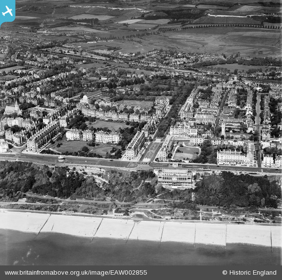
EAW002855 ENGLAND (1946). Leas Cliff Hall, Clifton Gardens and the surrounding residential area, Folkestone, 1946
© Copyright OpenStreetMap contributors and licensed by the OpenStreetMap Foundation. 2026. Cartography is licensed as CC BY-SA.
Nearby Images (19)
EAW002855

EPW009199

EAW024830

EAW002370

EPW009197

EPW000364

EAW002854

EPW035414

EAW002856

EAW002857

EAW024827

EPW000588

EAW002868

EPW000074

EPW009201

EAW024828

EAW002867

EAW002375

EAW002374

Details
| Title | [EAW002855] Leas Cliff Hall, Clifton Gardens and the surrounding residential area, Folkestone, 1946 |
| Reference | EAW002855 |
| Date | 1-October-1946 |
| Link | |
| Place name | FOLKESTONE |
| Parish | FOLKESTONE |
| District | |
| Country | ENGLAND |
| Easting / Northing | 622280, 135607 |
| Longitude / Latitude | 1.1735940329761, 51.076132044911 |
| National Grid Reference | TR223356 |
Pins

Sara |
Tuesday 12th of April 2022 07:50:14 PM | |
|
Sara |
Tuesday 12th of April 2022 07:49:32 PM | |
|
Sara |
Saturday 4th of August 2018 08:54:02 AM | |
|
Sara |
Saturday 4th of August 2018 08:53:05 AM | |

Sparky |
Saturday 16th of September 2017 12:26:15 PM | |
|
Sparky |
Saturday 16th of September 2017 12:24:51 PM | |
|
Paolo |
Thursday 14th of November 2013 10:18:33 PM | |
|
Paolo |
Thursday 14th of November 2013 10:16:31 PM |