
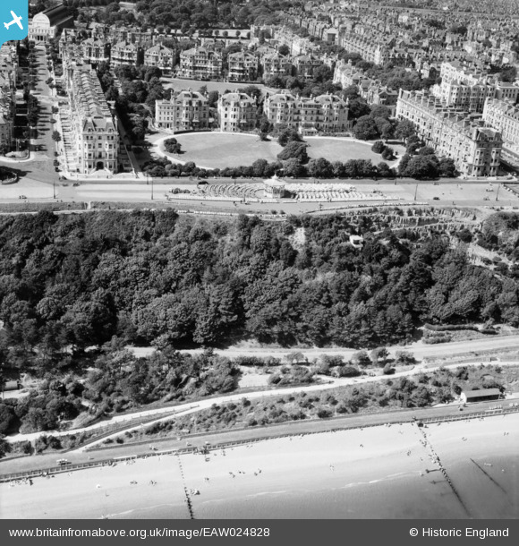
EAW024828 ENGLAND (1949). The bandstand and the Pulhamite Rock Garden on the Leas, Folkestone, 1949
© Copyright OpenStreetMap contributors and licensed by the OpenStreetMap Foundation. 2026. Cartography is licensed as CC BY-SA.
Nearby Images (21)
EAW024828

EPW009201

EPW035414

EPW009197

EAW002375

EAW024830

EAW002374

EAW002854

EPW000364

EAW002867

EAW024827

EPW000592

EAW002855

EPW000074

EPW000082

EAW002868

EAW002856

EAW024833

EPW009199

EAW002857

EPW000366

Details
| Title | [EAW024828] The bandstand and the Pulhamite Rock Garden on the Leas, Folkestone, 1949 |
| Reference | EAW024828 |
| Date | 12-July-1949 |
| Link | |
| Place name | FOLKESTONE |
| Parish | FOLKESTONE |
| District | |
| Country | ENGLAND |
| Easting / Northing | 622223, 135401 |
| Longitude / Latitude | 1.172654930262, 51.074304371735 |
| National Grid Reference | TR222354 |
Pins

redmist |
Thursday 24th of November 2022 09:07:42 PM |