
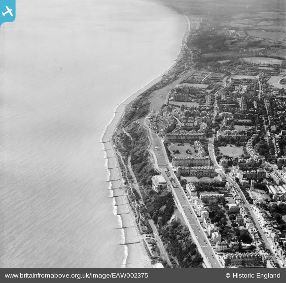
EAW002375 ENGLAND (1946). The Leas, Folkestone, 1946
© Copyright OpenStreetMap contributors and licensed by the OpenStreetMap Foundation. 2026. Cartography is licensed as CC BY-SA.
Nearby Images (17)
EAW002375

EAW002374

EPW009201

EAW024828

EPW000592

EPW000082

EAW024833

EPW000583

EAW002854

EPW000364

EAW024830

EPW000085

EPW009197

EAW024829

EPW035414

EPW000366

EAW002855

Details
| Title | [EAW002375] The Leas, Folkestone, 1946 |
| Reference | EAW002375 |
| Date | 9-September-1946 |
| Link | |
| Place name | FOLKESTONE |
| Parish | FOLKESTONE |
| District | |
| Country | ENGLAND |
| Easting / Northing | 622115, 135391 |
| Longitude / Latitude | 1.1711094109554, 51.074256386798 |
| National Grid Reference | TR221354 |
Pins

redmist |
Sunday 16th of February 2025 10:35:52 AM | |
|
redmist |
Sunday 16th of February 2025 10:33:07 AM | |
|
redmist |
Sunday 16th of February 2025 10:32:05 AM | |
|
Paolo |
Wednesday 29th of July 2015 09:35:53 PM | |
|
Paolo |
Wednesday 29th of July 2015 09:33:13 PM | |
|
Paolo |
Wednesday 29th of July 2015 09:32:17 PM | |
|
Paolo |
Wednesday 29th of July 2015 09:31:19 PM | |
|
Paolo |
Wednesday 29th of July 2015 09:29:49 PM | |
|
Paolo |
Wednesday 29th of July 2015 09:28:11 PM | |
|
Paolo |
Wednesday 29th of July 2015 09:27:00 PM |