
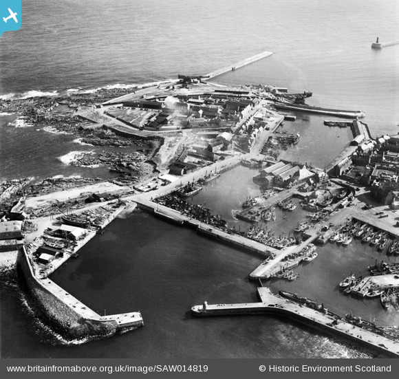
SAW014819 SCOTLAND (1948). Peterhead Harbour. An oblique aerial photograph taken facing south.
© Hawlfraint cyfranwyr OpenStreetMap a thrwyddedwyd gan yr OpenStreetMap Foundation. 2026. Trwyddedir y gartograffeg fel CC BY-SA.
Delweddau cyfagos (11)
SAW014819

SAW014825

SAW019632

SAW019634

SAW014820

SAW014821

SAW014824

SAW019631

SAW014822

SAW019635

SAW014823

Manylion
| Pennawd | [SAW014819] Peterhead Harbour. An oblique aerial photograph taken facing south. |
| Cyfeirnod | SAW014819 |
| Dyddiad | 1948 |
| Dolen | NRHE Collection item 1268921 |
| Enw lle | |
| Plwyf | MARITIME - ABERDEENSHIRE |
| Ardal | MARITIME |
| Gwlad | SCOTLAND |
| Dwyreiniad / Gogleddiad | 413800, 846100 |
| Hydred / Lledred | -1.7696797685987, 57.505116108188 |
| Cyfeirnod Grid Cenedlaethol | NK138461 |
Pinnau

Matt Aldred edob.mattaldred.com |
Thursday 4th of March 2021 03:21:23 PM | |
|
Matt Aldred edob.mattaldred.com |
Thursday 4th of March 2021 03:18:58 PM | |

redmist |
Saturday 30th of January 2021 10:04:19 AM |