
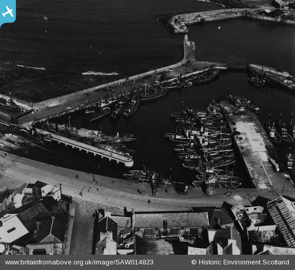
SAW014823 SCOTLAND (1948). Port Henry Harbour, Peterhead. An oblique aerial photograph taken facing east. This image has been produced from a print.
© Hawlfraint cyfranwyr OpenStreetMap a thrwyddedwyd gan yr OpenStreetMap Foundation. 2026. Trwyddedir y gartograffeg fel CC BY-SA.
Delweddau cyfagos (8)
SAW014823

SAW019635

SAW014820

SAW014821

SAW014824

SAW019631

SAW019634

SAW014819

Manylion
| Pennawd | [SAW014823] Port Henry Harbour, Peterhead. An oblique aerial photograph taken facing east. This image has been produced from a print. |
| Cyfeirnod | SAW014823 |
| Dyddiad | 1948 |
| Dolen | NRHE Collection item 1314742 |
| Enw lle | |
| Plwyf | MARITIME - ABERDEENSHIRE |
| Ardal | MARITIME |
| Gwlad | SCOTLAND |
| Dwyreiniad / Gogleddiad | 413600, 846300 |
| Hydred / Lledred | -1.7730065588593, 57.506918855812 |
| Cyfeirnod Grid Cenedlaethol | NK136463 |
