
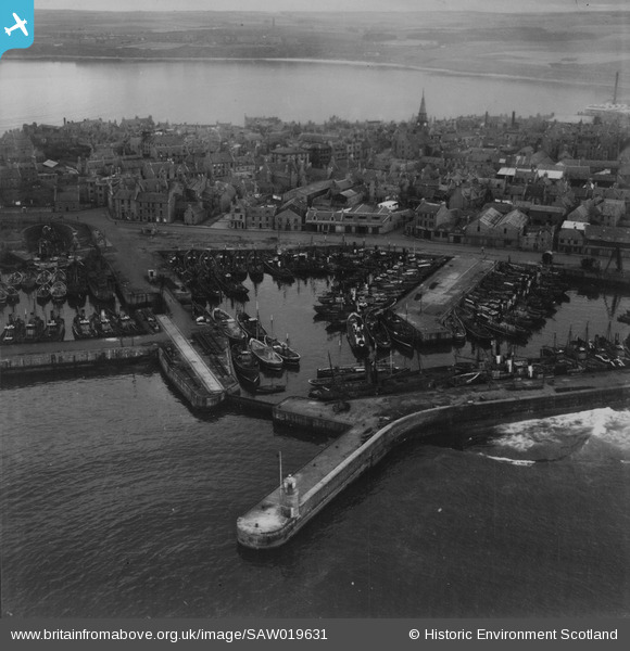
SAW019631 SCOTLAND (1948). Peterhead, general view, showing Port Henry Harbour and Peterhead Bay. An oblique aerial photograph taken facing west. This image has been produced from a print.
© Hawlfraint cyfranwyr OpenStreetMap a thrwyddedwyd gan yr OpenStreetMap Foundation. 2026. Trwyddedir y gartograffeg fel CC BY-SA.
Delweddau cyfagos (8)
SAW014820

SAW014821

SAW014824

SAW019631

SAW019634

SAW014823

SAW019635

SAW014819

Manylion
| Pennawd | [SAW019631] Peterhead, general view, showing Port Henry Harbour and Peterhead Bay. An oblique aerial photograph taken facing west. This image has been produced from a print. |
| Cyfeirnod | SAW019631 |
| Dyddiad | 1948 |
| Dolen | NRHE Collection item 1315004 |
| Enw lle | |
| Plwyf | MARITIME - ABERDEENSHIRE |
| Ardal | MARITIME |
| Gwlad | SCOTLAND |
| Dwyreiniad / Gogleddiad | 413600, 846200 |
| Hydred / Lledred | -1.7730121360208, 57.506020505862 |
| Cyfeirnod Grid Cenedlaethol | NK136462 |
Pinnau

redmist |
Saturday 30th of January 2021 10:42:47 AM |