
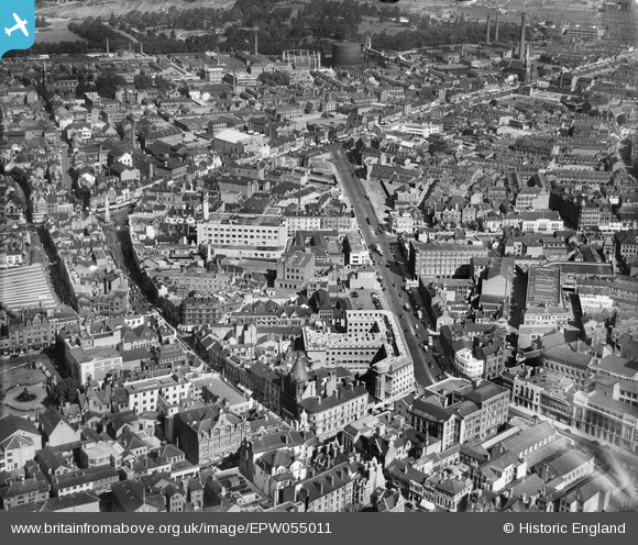
EPW055011 ENGLAND (1937). Charles Street and the city centre, Leicester, 1937
© Hawlfraint cyfranwyr OpenStreetMap a thrwyddedwyd gan yr OpenStreetMap Foundation. 2026. Trwyddedir y gartograffeg fel CC BY-SA.
Delweddau cyfagos (32)
EPW055011

EPW018422

EAW024244

EPW018412

EAW024239

EAW024240

EPW018431

EAW051834

EPW061213

EPW018436

EAW024242

EPW055009

EAW024243

EPW020892

EAW051831

EPW018421

EAW052680
 Factory on Charles Street, Leicester, 1953. This image was marked by Aerofilms Ltd for photo editing.")
EPW047643

EPW055002

EAW052674
 Factory on Charles Street, St George's Church and Rutland Street, Leicester, 1953. This image was marked by Aerofilms Ltd for photo editing.")
EAW052676
 Factory on Charles Street and St George's Church, Leicester, 1953. This image was marked by Aerofilms Ltd for photo editing.")
EPW047645

EPW047641

EAW052675
 Factory on Charles Street, Leicester, 1953. This image was marked by Aerofilms Ltd for photo editing.")
EPW018433

EPW020895

EPW047868

EAW052679
 Factory on Charles Street, Leicester, 1953. This image was marked by Aerofilms Ltd for photo editing.")
EAW052681
 Factory on Charles Street and St George's Church, Leicester, 1953. This image was marked by Aerofilms Ltd for photo editing.")
EPW055006

EAW052677

EAW052678
 Factory on Charles Street, Leicester, 1953. This image was marked by Aerofilms Ltd for photo editing.")
Manylion
| Pennawd | [EPW055011] Charles Street and the city centre, Leicester, 1937 |
| Cyfeirnod | EPW055011 |
| Dyddiad | August-1937 |
| Dolen | |
| Enw lle | LEICESTER |
| Plwyf | |
| Ardal | |
| Gwlad | ENGLAND |
| Dwyreiniad / Gogleddiad | 458941, 304534 |
| Hydred / Lledred | -1.1289647765157, 52.635000002452 |
| Cyfeirnod Grid Cenedlaethol | SK589045 |
Pinnau

neil |
Friday 14th of January 2022 07:46:28 PM | |
|
neil |
Friday 14th of January 2022 07:45:50 PM | |
|
diag |
Sunday 22nd of September 2013 07:28:26 PM | |
|
diag |
Sunday 22nd of September 2013 07:26:14 PM | |
|
diag |
Sunday 22nd of September 2013 07:25:40 PM |