
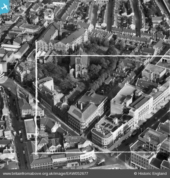
EAW052677 ENGLAND (1953). Rutland Street and St George's Church, Leicester, 1953. This image was marked by Aerofilms Ltd for photo editing.
© Hawlfraint cyfranwyr OpenStreetMap a thrwyddedwyd gan yr OpenStreetMap Foundation. 2026. Trwyddedir y gartograffeg fel CC BY-SA.
Delweddau cyfagos (23)
EAW052677

EAW052681
 Factory on Charles Street and St George's Church, Leicester, 1953. This image was marked by Aerofilms Ltd for photo editing.")
EAW052679
 Factory on Charles Street, Leicester, 1953. This image was marked by Aerofilms Ltd for photo editing.")
EAW052678
 Factory on Charles Street, Leicester, 1953. This image was marked by Aerofilms Ltd for photo editing.")
EAW052674
 Factory on Charles Street, St George's Church and Rutland Street, Leicester, 1953. This image was marked by Aerofilms Ltd for photo editing.")
EPW018459

EAW052675
 Factory on Charles Street, Leicester, 1953. This image was marked by Aerofilms Ltd for photo editing.")
EAW052676
 Factory on Charles Street and St George's Church, Leicester, 1953. This image was marked by Aerofilms Ltd for photo editing.")
EAW052680
 Factory on Charles Street, Leicester, 1953. This image was marked by Aerofilms Ltd for photo editing.")
EPW055009

EPW018428

EPW055002

EPW055003

EPW061213

EPW055011

EAW052689
 Factory on Campbell Street and London Road Railway Station, Leicester, 1953. This image was marked by Aerofilms Ltd for photo editing.")
EAW052685
 Factory on Campbell Street and London Road Railway Station, Leicester, 1953. This image was marked by Aerofilms Ltd for photo editing.")
EAW052686
 Factory on Campbell Street and London Road Railway Station, Leicester, 1953. This image was marked by Aerofilms Ltd for photo editing.")
EAW052688
 Factory on Campbell Street and London Road Railway Station, Leicester, 1953. This image was marked by Aerofilms Ltd for photo editing.")
EAW052687
 Factory on Campbell Street and London Road Railway Station, Leicester, 1953. This image was marked by Aerofilms Ltd for photo editing.")
EAW052684
 Factory on Campbell Street, Leicester, 1953. This image was marked by Aerofilms Ltd for photo editing.")
EAW052683
 Factory on Campbell Street and London Road Railway Station, Leicester, 1953. This image was marked by Aerofilms Ltd for photo editing.")
EAW052682
 Factory on Campbell Street and London Road Railway Station, Leicester, 1953. This image was marked by Aerofilms Ltd for photo editing.")
Manylion
| Pennawd | [EAW052677] Rutland Street and St George's Church, Leicester, 1953. This image was marked by Aerofilms Ltd for photo editing. |
| Cyfeirnod | EAW052677 |
| Dyddiad | 1-October-1953 |
| Dolen | |
| Enw lle | LEICESTER |
| Plwyf | |
| Ardal | |
| Gwlad | ENGLAND |
| Dwyreiniad / Gogleddiad | 459171, 304429 |
| Hydred / Lledred | -1.1255850668722, 52.634031048121 |
| Cyfeirnod Grid Cenedlaethol | SK592044 |
