
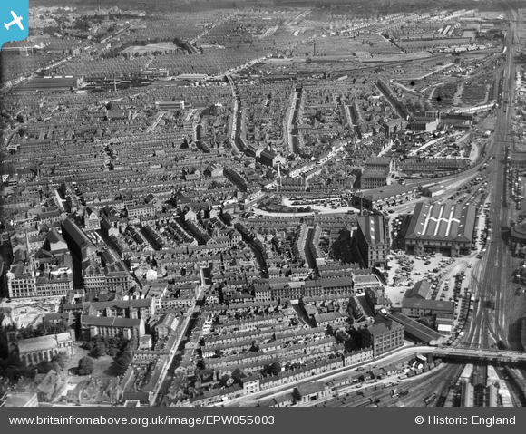
EPW055003 ENGLAND (1937). London Road Railway Goods Sheds off Humberstone Road and the city, Leicester, from the south-west 1937
© Hawlfraint cyfranwyr OpenStreetMap a thrwyddedwyd gan yr OpenStreetMap Foundation. 2026. Trwyddedir y gartograffeg fel CC BY-SA.
Delweddau cyfagos (7)
EPW055003

EPW018428

EPW018459

EAW052677

EAW052678
 Factory on Charles Street, Leicester, 1953. This image was marked by Aerofilms Ltd for photo editing.")
EAW052681
 Factory on Charles Street and St George's Church, Leicester, 1953. This image was marked by Aerofilms Ltd for photo editing.")
EAW052679
 Factory on Charles Street, Leicester, 1953. This image was marked by Aerofilms Ltd for photo editing.")
Manylion
| Pennawd | [EPW055003] London Road Railway Goods Sheds off Humberstone Road and the city, Leicester, from the south-west 1937 |
| Cyfeirnod | EPW055003 |
| Dyddiad | August-1937 |
| Dolen | |
| Enw lle | LEICESTER |
| Plwyf | |
| Ardal | |
| Gwlad | ENGLAND |
| Dwyreiniad / Gogleddiad | 459367, 304473 |
| Hydred / Lledred | -1.1226810819191, 52.634405186828 |
| Cyfeirnod Grid Cenedlaethol | SK594045 |
Pinnau

mikeyp |
Friday 17th of February 2023 05:17:34 PM | |
|
mikeyp |
Friday 17th of February 2023 05:15:08 PM | |
|
mikeyp |
Friday 17th of February 2023 05:14:19 PM | |
|
davewig |
Tuesday 29th of September 2020 04:42:25 PM | |
|
davewig |
Tuesday 29th of September 2020 04:33:15 PM | |
|
davewig |
Tuesday 29th of September 2020 04:28:04 PM | |
|
davewig |
Tuesday 29th of September 2020 04:23:20 PM | |
|
gBr |
Thursday 5th of January 2017 10:10:52 PM | |
|
c j moon |
Friday 25th of April 2014 05:50:47 PM | |
|
c j moon |
Friday 25th of April 2014 05:49:12 PM |