
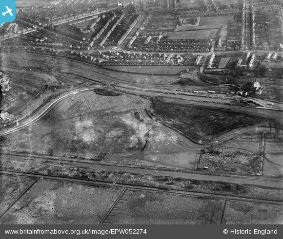
EPW052274 ENGLAND (1936). The site of the southern end of the William Girling Reservoir showing preliminary construction works, Edmonton, 1936. This image has been produced from a damaged negative.
© Hawlfraint cyfranwyr OpenStreetMap a thrwyddedwyd gan yr OpenStreetMap Foundation. 2026. Trwyddedir y gartograffeg fel CC BY-SA.
Delweddau cyfagos (22)
EPW052274

EPW056815

EPW053843
 Reservoir under construction, Edmonton, 1937")
EPW056821

EPW060635

EPW056319

EPW058461
 Reservoir under construction and the River Lea, Edmonton, 1938")
EPW055980

EPW052287

EPW058465
 Reservoir under construction, Edmonton, 1938")
EPW049696

EPW053836

EPW049715

EPW049523

EPW055981

EPW058467

EPW056320

EPW060629

EPW056326

EPW049528

EPW056822

EPW050859

Manylion
| Pennawd | [EPW052274] The site of the southern end of the William Girling Reservoir showing preliminary construction works, Edmonton, 1936. This image has been produced from a damaged negative. |
| Cyfeirnod | EPW052274 |
| Dyddiad | November-1936 |
| Dolen | |
| Enw lle | EDMONTON |
| Plwyf | |
| Ardal | |
| Gwlad | ENGLAND |
| Dwyreiniad / Gogleddiad | 536219, 192702 |
| Hydred / Lledred | -0.032267319494531, 51.616169534456 |
| Cyfeirnod Grid Cenedlaethol | TQ362927 |
Pinnau
Byddwch y cyntaf i ychwanegu sylw at y ddelwedd hon!