
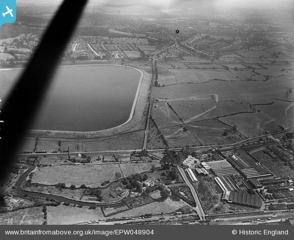
EPW048904 ENGLAND (1935). The southern end of King George's Reservoir, the Charlotte Cabinet Works and Lea Valley Road, Ponders End, 1935
© Hawlfraint cyfranwyr OpenStreetMap a thrwyddedwyd gan yr OpenStreetMap Foundation. 2026. Trwyddedir y gartograffeg fel CC BY-SA.
Delweddau cyfagos (17)
EPW048904

EPW049704

EPW058466
 Reservoir under construction, Edmonton, 1938")
EPW056819

EPW058455
 Reservoir under construction, Edmonton, 1938")
EPW049697

EPW060632

EPW056827

EPW048906

EPW060637

EPW048902

EPW049713

EPW055986

EPW053839
 Reservoir under construction, Edmonton, 1937")
EPW056328

EPW049717

EPW050860

Manylion
| Pennawd | [EPW048904] The southern end of King George's Reservoir, the Charlotte Cabinet Works and Lea Valley Road, Ponders End, 1935 |
| Cyfeirnod | EPW048904 |
| Dyddiad | August-1935 |
| Dolen | |
| Enw lle | PONDERS END |
| Plwyf | |
| Ardal | |
| Gwlad | ENGLAND |
| Dwyreiniad / Gogleddiad | 536702, 195363 |
| Hydred / Lledred | -0.024255727113697, 51.639966732057 |
| Cyfeirnod Grid Cenedlaethol | TQ367954 |
Pinnau
Byddwch y cyntaf i ychwanegu sylw at y ddelwedd hon!