
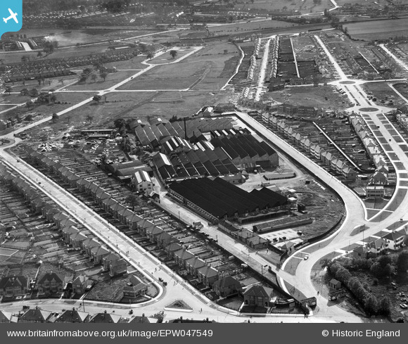
EPW047549 ENGLAND (1935). The former works of De Havilland at Stag Lane and housing at Holyrood Gardens and De Havilland Road, Queensbury, 1935
© Hawlfraint cyfranwyr OpenStreetMap a thrwyddedwyd gan yr OpenStreetMap Foundation. 2026. Trwyddedir y gartograffeg fel CC BY-SA.
Delweddau cyfagos (48)
EPW047549

EPW047554

EPW018765

EPW047557

EPW047552

EPW032890

EPW013196

EPW047556

EPW046487

EPW032892

EPW046486

EPW046490

EPW009129

EPW032889

EPW047550

EPW025073

EPW022048

EPW047553

EPW013198

EPW022364

EPW034797

EPW030057

EPW025691

EPW030058

EPW031547

EPW034980

EPW034980
EPW017872

EPW017873

EPW017874

EPW017875

EPW017876

EPW017877

EPW017878

EPW017880

EPW034987

EPW046489

EPW025074

EPW030056

EPW018132

EPW046485

EPW034981

EPW034981
EPW018148

EPW031546

EPW035016

EPW035010

EPW031582

Manylion
| Pennawd | [EPW047549] The former works of De Havilland at Stag Lane and housing at Holyrood Gardens and De Havilland Road, Queensbury, 1935 |
| Cyfeirnod | EPW047549 |
| Dyddiad | June-1935 |
| Dolen | |
| Enw lle | QUEENSBURY |
| Plwyf | |
| Ardal | |
| Gwlad | ENGLAND |
| Dwyreiniad / Gogleddiad | 519665, 190124 |
| Hydred / Lledred | -0.27215063087362, 51.596761310065 |
| Cyfeirnod Grid Cenedlaethol | TQ197901 |
Pinnau

dd |
Wednesday 27th of May 2026 11:51:22 AM | |
|
Gladstone Hay |
Thursday 5th of December 2013 10:47:21 PM | |
|
Gladstone Hay |
Thursday 5th of December 2013 10:47:03 PM | |
|
colsouth111 |
Monday 10th of June 2013 08:06:40 PM | |
|
colsouth111 |
Monday 10th of June 2013 08:05:45 PM | |
|
colsouth111 |
Monday 10th of June 2013 08:04:04 PM |
Cyfraniadau Grŵp

Taken from the opposite direction to the previous photo and four years later we can now Queensbury rapidly filling those empty fields. In the distance the station and leading to it from the left Beverley Drive, and on the right Mollison Way. |
colsouth111 |
Thursday 20th of June 2013 11:33:50 AM |
Can see Lawrence Crescent and Reynolds Drive between Mollison Way and Beverly Drive. Think my parents bought the house in Lawrence Crescent circa 1937. Notice no shops in Mollison Way. |
Norman Vickery |
Thursday 20th of June 2013 11:33:50 AM |