
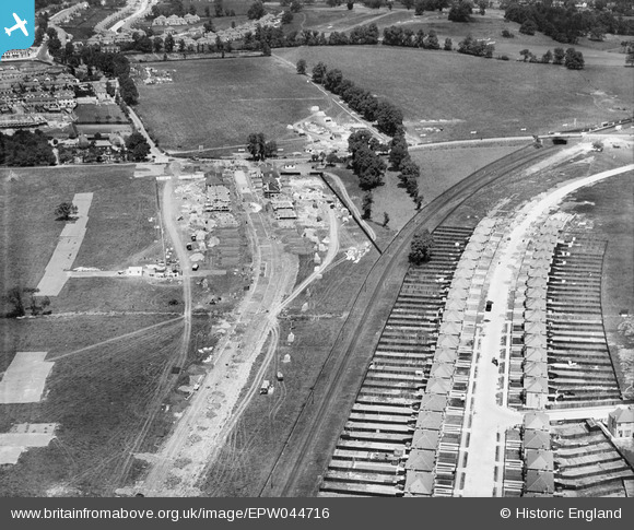
EPW044716 ENGLAND (1934). Housing under construction along Grasmere Gardens and environs, Belmont, 1934
© Hawlfraint cyfranwyr OpenStreetMap a thrwyddedwyd gan yr OpenStreetMap Foundation. 2026. Trwyddedir y gartograffeg fel CC BY-SA.
Delweddau cyfagos (11)
EPW044716

EPW044715

EPW044726

EPW044281

EPW044282

EPW044712

EPW044285

EPW044284

EPW044713

EPW044283

EPW044714

Manylion
| Pennawd | [EPW044716] Housing under construction along Grasmere Gardens and environs, Belmont, 1934 |
| Cyfeirnod | EPW044716 |
| Dyddiad | June-1934 |
| Dolen | |
| Enw lle | BELMONT |
| Plwyf | |
| Ardal | |
| Gwlad | ENGLAND |
| Dwyreiniad / Gogleddiad | 516330, 190143 |
| Hydred / Lledred | -0.32027597372025, 51.597630848548 |
| Cyfeirnod Grid Cenedlaethol | TQ163901 |
