
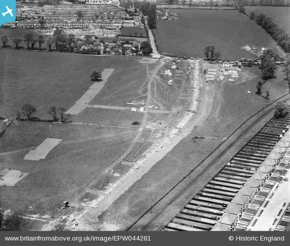
EPW044281 ENGLAND (1934). Construction site for housing at Grasmere Gardens, Harrow, 1934
© Hawlfraint cyfranwyr OpenStreetMap a thrwyddedwyd gan yr OpenStreetMap Foundation. 2026. Trwyddedir y gartograffeg fel CC BY-SA.
Delweddau cyfagos (10)
EPW044281

EPW044282

EPW044715

EPW044726

EPW044285

EPW044284

EPW044716

EPW044283

EPW044712

EPW044713

Manylion
| Pennawd | [EPW044281] Construction site for housing at Grasmere Gardens, Harrow, 1934 |
| Cyfeirnod | EPW044281 |
| Dyddiad | May-1934 |
| Dolen | |
| Enw lle | HARROW |
| Plwyf | |
| Ardal | |
| Gwlad | ENGLAND |
| Dwyreiniad / Gogleddiad | 516253, 190089 |
| Hydred / Lledred | -0.32140518461683, 51.597161370156 |
| Cyfeirnod Grid Cenedlaethol | TQ163901 |
Pinnau

simes188 |
Thursday 27th of January 2022 01:10:29 PM | |
|
czyrko |
Thursday 26th of August 2021 02:28:20 PM | |
|
czyrko |
Thursday 26th of August 2021 02:27:15 PM | |
|
simes188 |
Sunday 16th of April 2017 06:24:17 PM | |
|
simes188 |
Friday 29th of November 2013 07:44:08 PM | |
|
simes188 |
Friday 29th of November 2013 07:43:37 PM | |
|
simes188 |
Friday 29th of November 2013 07:42:53 PM | |
|
simes188 |
Friday 29th of November 2013 07:42:03 PM |