
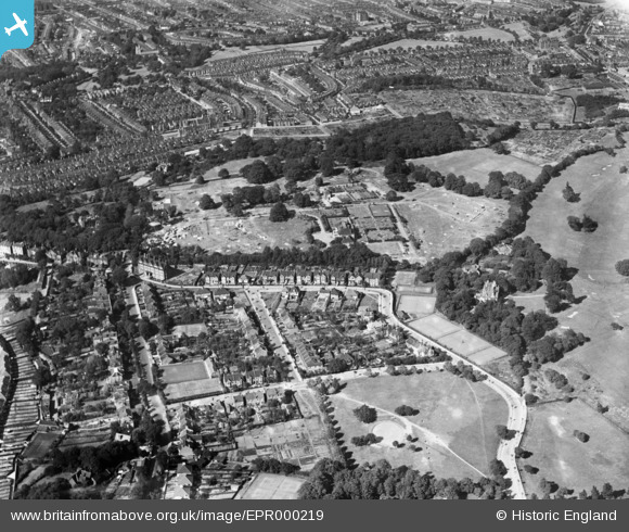
EPR000219 ENGLAND (1934). Eaglesfield Road, Cleanthus Road and the Shrewsbury Park Estate under construction, Shooters Hill, 1934
© Hawlfraint cyfranwyr OpenStreetMap a thrwyddedwyd gan yr OpenStreetMap Foundation. 2026. Trwyddedir y gartograffeg fel CC BY-SA.
Delweddau cyfagos (10)
EPR000219

EPR000216

EPR000120

EPR000123

EPR000217

EPR000215

EPR000218

EPR000126

EPR000214

EPR000124

Manylion
| Pennawd | [EPR000219] Eaglesfield Road, Cleanthus Road and the Shrewsbury Park Estate under construction, Shooters Hill, 1934 |
| Cyfeirnod | EPR000219 |
| Dyddiad | 17-July-1934 |
| Dolen | |
| Enw lle | SHOOTERS HILL |
| Plwyf | |
| Ardal | |
| Gwlad | ENGLAND |
| Dwyreiniad / Gogleddiad | 544034, 176980 |
| Hydred / Lledred | 0.074109153613025, 51.472937737913 |
| Cyfeirnod Grid Cenedlaethol | TQ440770 |
Pinnau

RichMoly |
Sunday 11th of January 2015 03:01:52 PM |