
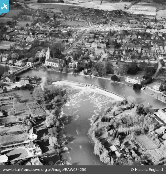
eaw034259 ENGLAND (1950). Marlow Weir and the town, Marlow, 1950
© Copyright OpenStreetMap contributors and licensed by the OpenStreetMap Foundation. 2025. Cartography is licensed as CC BY-SA.
Nearby Images (19)
EAW034259

EPW000915

EAW028004

EAW028002

EPW000922

EAW028003

EAW034636

EAW034635

EPW052602

EAW045413

EAW045411

EAW028005

EAW045412

EPW022689

EPW022691

EPW000923

EPW012123

EAW034257

EPW052603

Details
| Title | [EAW034259] Marlow Weir and the town, Marlow, 1950 |
| Reference | EAW034259 |
| Date | 14-November-1950 |
| Link | |
| Place name | MARLOW |
| Parish | MARLOW |
| District | |
| Country | ENGLAND |
| Easting / Northing | 485243, 186157 |
| Longitude / Latitude | -0.76998681053539, 51.567359707053 |
| National Grid Reference | SU852862 |
Pins
 misterjohn |
Tuesday 3rd of January 2023 12:45:36 PM | |
misterjohn |
Tuesday 3rd of January 2023 12:44:19 PM | |
misterjohn |
Tuesday 3rd of January 2023 12:42:48 PM | |
misterjohn |
Tuesday 3rd of January 2023 12:41:43 PM | |
misterjohn |
Tuesday 3rd of January 2023 12:41:16 PM |