
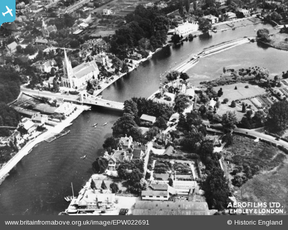
EPW022691 ENGLAND (1928). All Saints' Church alongside Marlow Bridge and Weir, Bisham, 1928. This image has been produced from a copy-negative.
© Copyright OpenStreetMap contributors and licensed by the OpenStreetMap Foundation. 2026. Cartography is licensed as CC BY-SA.
Nearby Images (21)
EPW022691

EPW022689

EAW028003

EPW000922

EPW000915

EPW052602

EAW028005

EPW052603

EAW028004

EAW028002

EAW034259

EPW000923

EAW045411

EAW034636

EAW034635

EPW000920

EAW045413

EPW001019

EPW012123

EAW045412

EPW052745

Details
| Title | [EPW022691] All Saints' Church alongside Marlow Bridge and Weir, Bisham, 1928. This image has been produced from a copy-negative. |
| Reference | EPW022691 |
| Date | 15-August-1928 |
| Link | |
| Place name | BISHAM |
| Parish | BISHAM |
| District | |
| Country | ENGLAND |
| Easting / Northing | 485137, 186053 |
| Longitude / Latitude | -0.77154115967968, 51.566440730447 |
| National Grid Reference | SU851861 |
Pins
Be the first to add a comment to this image!