
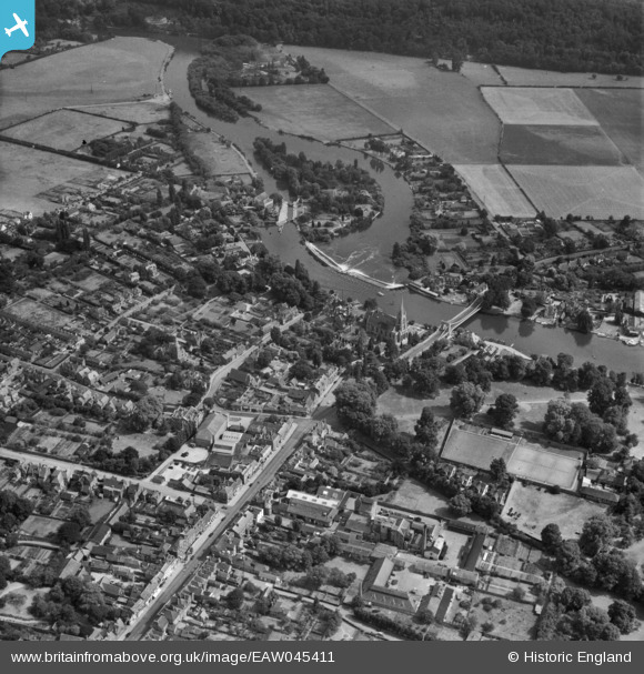
EAW045411 ENGLAND (1952). Lock Island, All Saints' Church and the surrounding area, Marlow, 1952
© Copyright OpenStreetMap contributors and licensed by the OpenStreetMap Foundation. 2026. Cartography is licensed as CC BY-SA.
Nearby Images (19)
EAW045411

EPW000915

EAW034259

EAW045413

EPW000922

EAW028003

EAW028004

EAW028002

EPW052602

EAW034636

EAW034635

EPW022689

EAW028005

EPW022691

EAW045412

EPW000923

EPW012123

EPW052603

EPW000920

Details
| Title | [EAW045411] Lock Island, All Saints' Church and the surrounding area, Marlow, 1952 |
| Reference | EAW045411 |
| Date | 6-August-1952 |
| Link | |
| Place name | MARLOW |
| Parish | MARLOW |
| District | |
| Country | ENGLAND |
| Easting / Northing | 485188, 186208 |
| Longitude / Latitude | -0.77076786954356, 51.567826527825 |
| National Grid Reference | SU852862 |
Pins
Be the first to add a comment to this image!