
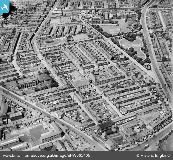
EPW061405 ENGLAND (1939). Hopwood Street Mills, St Paul's Church and surrounding streets, Preston, 1939
© Copyright OpenStreetMap contributors and licensed by the OpenStreetMap Foundation. 2026. Cartography is licensed as CC BY-SA.
Nearby Images (18)
EPW061405

EPW061404

EPW061402

EAW034010

EAW034011

EAW034012

EAW034007

EAW034014

EAW034009

EAW034008

EAW034013

EAW015903

EAW015906

EPW061403

EAW015923

EPW061400

EPW061401

EPW061406

Details
| Title | [EPW061405] Hopwood Street Mills, St Paul's Church and surrounding streets, Preston, 1939 |
| Reference | EPW061405 |
| Date | 2-June-1939 |
| Link | |
| Place name | PRESTON |
| Parish | |
| District | |
| Country | ENGLAND |
| Easting / Northing | 354442, 429840 |
| Longitude / Latitude | -2.6911635419658, 53.762699308794 |
| National Grid Reference | SD544298 |
Pins

Ragtag |
Thursday 7th of August 2014 11:11:39 AM | |
|
Ragtag |
Thursday 7th of August 2014 11:10:48 AM | |
|
Ragtag |
Thursday 7th of August 2014 11:06:44 AM | |
|
Ragtag |
Thursday 7th of August 2014 11:04:30 AM | |
|
Ragtag |
Thursday 7th of August 2014 11:03:39 AM |